We took advantage of a nice evening the other day to take a family hike up Badger Mountain. News in the paper that morning said there was a newly opened trail and I hoped we'd come across it. We got on what I call the "Family Trail" at the park at the top of Shockley Road in Richland and started hiking. At the top of the first ridge was the sign directing us to the new trail! We headed off to the east and found a nice change of scenery as we followed the trail through the beautiful sagebrush. Of course, there were plenty of wildflowers. We followed the trail to the radio towers at the top of Badger Mountain and then we came back down the "Family Trail" making a loop of about 3.75 miles by my GPS. Here's an overlay of the GPS route on a Google Earth image. If you've never hiked up Badger Mountain, we encourage you to enjoy one of the wonderful things we have to enjoy here in the Tri-Cities. Just for your orientation, the image above is looking towards the southwest.
We were fortunate a few of my days off corresponded with the boys spring break so we took the chance to get away to play. We started in Kellogg, Idaho at the Silver Mountain Resort. Its the same place we went last year, we enjoyed it so we went back. We stayed in a nice condo and played the first afternoon at the Silver Rapids indoor water park. It was a lot of fun. It isn't that big (compared to Silverwood or Roaring Springs) but you may have guessed I love to play in the water so it was still a blast. We had fun squirting other unsuspecting people on the kiddie play structure (probably our favorite thing to do, even if the lifeguards give us a few stares!). We also had fun on the family tube ride, basketball area, lazy river and so on. Justin and I had a good time on the Flowrider. The Flowrider is an artificial wave machine you can board or surf on. The first video has a few seconds of us each on the water.
Silver Rapids Flowrider
The next night, we headed for Spokane. We found a decent hotel and just kind of relaxed. We enjoyed a dinner out at Chili's and we got a little bit of a scare as we weren't sure where the car was parked when we got done (I was wondering if it was stolen!). Turns out, we were just a block off on our calculations (I should have had my GPS).The next day, we explored Spokane. Though we lived here for about a year when we were first married (we liked living in Spokane), we didn't enjoy all the activities available. We had a good time at the IMAX theater watching Hubble. A fascinating movie with amazing pictures (even though it was only 2D). We wandered around Riverfront Park a little and took a spin on the carousel. We actually got snowed on and hailed on for a few minutes but it didn't dampen our spirits. We also went to Manito Park, just a block from where we lived. Denise had us turn up one road and we found the beautiful Gaiser Conservatory. Watch this video and it starts out with the green house which has color galore. Vibrant reds, purples, yellows. There's a neat, small tree called a "bottle brush" tree that actually has red blooms that look like bottle brushes. There was a living, plant, Easter Bunny (for the season). Then, watch for the cactus green house with prickly plants from all over the world!
Gaiser Conservatory On our journey home, we wandered through the Channeled Scablands of eastern Washington. In the middle of nowhere, we stopped off at Palouse Falls. A beautiful waterfall that was running strong with the spring runoff. We wanted to take a hike so we ventured up river and got above the big falls.
Upper Palouse Falls
There we found some more falls and hiked out to the point above the big falls. We hope you enjoy our pictures and videos just as we enjoyed our spring break trip!
Well, the desert is really blooming and I coaxed the family up the steep trail to look at the beautiful colors before the summer dries up Badger Mountain. It was a little windy (see the grass picture) but we had a great hike. I'm not sure of all the names of these flowers but I hope you enjoy them. The trail is from the Country Ridge area of Richland. It's a steep trail, that's why I like it. It gives me a good workout. Normal time to the top is 18 minutes or so. I hope to improve my times throughout the year. Enjoy the flower pictures and I included a Google Earth overlay of my GPS route. If you know the area, you'll see how outdated the image is as there are several homes now in the trailhead area.
The Magnolia is flowering and that can mean only one thing, it's time for the annual family picture! We are missing one important family member but we know Spencer is in the right place serving in Mexico! From left to right: Mindy (with rescued cat Riley), Paul, Justin, Denise, Nate. Enjoy! All our love to you!
I decided to check out a new mountain bike riding area I've heard of over the years. It's out by the State Patrol office near I-82 (you can see the office on the middle left edge of the Google Earth image). It was a neat riding area with lots of single-track trails. The main ascending trail has lots of jumps and stunt areas (I stayed clear of those and another hospital trip!) Then, you are on the top side in the bottom of the picture and you can go down any of several trails. It's a nice, semi-gradual ride to the top then you can blast back down any of the down runs. I also rode up a neighboring hill then back down, a nice run through the desert sagebrush!
Here's a couple of new perspectives on the Rattlesnake hikes we've taken. I took Nate and Justin with me the other day and we hiked about 8 miles. You can see my first two hikes and the lengthier one with the boys all on the same map for comparison. We may go out and spend the night out there later this week so look for more posts! See Ya!
Two days later, I was back on the Rattlesnake Natural Preserve. I wanted to explore the area more. I went to the top of the hill for a great view over the other side to Benton City, the Horse Heaven Hills, Mount Adams and the Lower Yakima Valley. On my way back down, I ventured over to the gulley and hiked it back with beautiful rock formations. I flushed out several sage birds along the way. I so enjoy the chance to see all the beauty that is here in the desert. It is nice to just be able to walk and watch and get exercise. You can see my path from the trailhead on the map picture. I also wanted to share some of the pictures I took. I hope you enjoy them and get a little taste of this beautiful area. Paul.
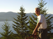
I'm a father of 3 with an amazing wife. I have two super sisters and one awesome brother. I love family time, especially when we're enjoying the great outdoors camping, backpacking or hiking. I love riding my bicycles (road or mountain). I love swimming the Columbia River. I love hiking around the Tri-Cities. I started this blog to help people discover some of the beauty that is right outside our doors here in the Columbia Basin. I hope you will take advantage of these posts by either by enjoying the content, video, pictures and maps or going out and exploring these areas on your own. Please give me feedback as I am always looking for new adventures and I am imperfect so I will make mistakes and welcome corrections. Please browse around, take advantage of my advertisers if they can benefit you and enjoy!